Bahasa Indonesia
How Geofence Helps Businesses Manage Their Fleets in Real Time
Posted on July 15, 2026 by Nur Wachda Mihmidati
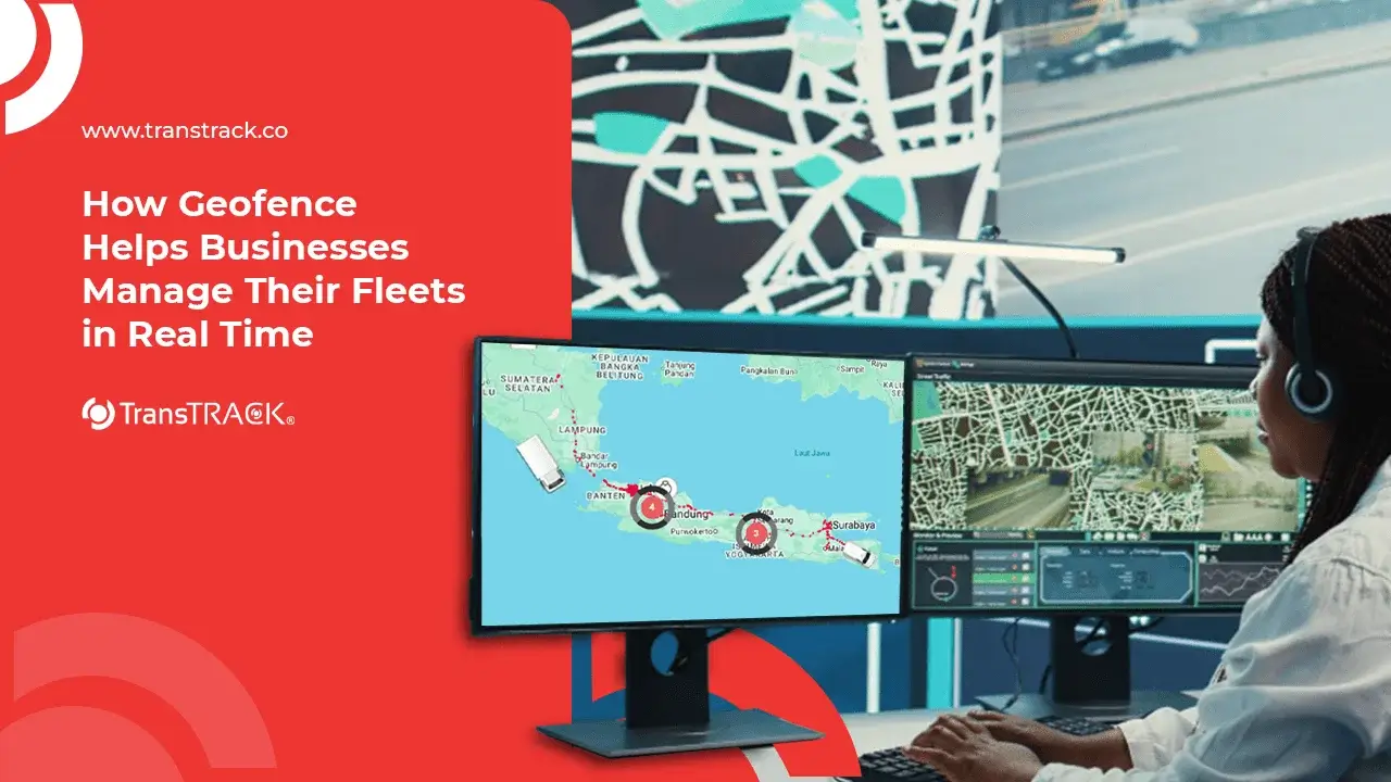
A geofence is a virtual area designed to monitor the movement of objects based on their geographic location. When a vehicle or asset enters or exits that area, the system automatically triggers specific actions, such as sending notifications or updating operational status. Read the full explanation in the following TransTRACK article!
What is a Geofence?
Geofencing is a technology that creates a virtual boundary (virtual fence) within a geographic area using GPS, Wi-Fi, Bluetooth, or cellular networks. When a device (such as a smartphone or vehicle) enters or exits that area, the system triggers a specific action or notification.
What Is the Purpose of Geofencing?
Geofencing creates virtual boundaries around a specific area so that the system can automatically detect when a person, vehicle, or asset enters or exits that area. This technology uses GPS, Wi-Fi, Bluetooth, or cellular networks to monitor locations in real time and trigger actions based on predefined rules.
1. Monitoring Vehicle Movement
Geofencing helps companies know when vehicles enter or leave specific locations, such as warehouses, offices, ports, or project sites.
2. Enhancing Asset Security
The system can send automatic notifications if a vehicle or asset leaves an authorized area, thereby minimizing the risk of loss or misuse.
3. Optimizing Fleet Operations
With geofencing, companies can track arrival and departure times, as well as the length of time a vehicle spends at a location, to improve operational efficiency.
4. Supporting Employee Management
Geofencing is often used in location-based attendance systems so that employees can only check in and check out when they are within a designated work area.
5. Automating Business Processes
Various processes can run automatically, such as sending notifications to customers when a shipment arrives, updating shipment status, or generating activity reports based on location.
6. Improving the Customer Experience
Businesses can send promotions, information, or special offers to customers when they are near a specific store or branch.
7. Assisting with Location Data Analysis
Data from geofencing can be used to analyze vehicle movement patterns, location visit rates, operating hours, and distribution efficiency, enabling companies to make more informed decisions.
What Is the Main Purpose of Using Geofencing in Business?
The primary purpose of using geofencing in business is to improve operational efficiency, security, and service quality through automated location monitoring. By setting virtual boundaries around specific areas, companies can track when vehicles, assets, employees, or customers enter or exit a location, enabling various business processes to operate in real time.
Some of the main purposes of geofencing in business include:
- Improving operational efficiency by automating processes such as recording arrival and departure times and the duration of activities at a location.
- Enhancing asset security through automatic notifications when a vehicle or asset leaves a designated area.
- Optimize fleet management by monitoring vehicle movements, ensuring route compliance, and reducing wait times and delays.
- Improving employee productivity through a location-based attendance system and field activity monitoring.
- Improve customer satisfaction by providing real-time shipping information, more accurate arrival estimates, or location-based offers.
- Supports data-driven decision-making through analysis of movement patterns, operating hours, and activities at various locations.
Overall, geofencing helps businesses reduce manual work, speed up responses to various on-site conditions, and improve efficiency, safety, and productivity across various sectors, such as logistics, transportation, manufacturing, mining, agriculture, and retail.
What Is the Difference Between Geotagging and Geofencing?
Geotagging and geofencing both utilize location technology, but they have different functions and work in different ways. Geotagging is used to add location information to data or an object, while geofencing is used to create virtual boundaries that can trigger automatic actions when a device enters or leaves a specific area. In short, geotagging records the location of an object, while geofencing monitors movement within an area and triggers automatic actions based on location.
| Aspek | Geotagging | Geofencing |
| Definition | Add location coordinates (latitude and longitude) to photos, videos, documents, or other data. | Create a virtual boundary around a specific area to monitor the movement of devices or assets. |
| Objective | Indicates the location where data was created or obtained. | Automate actions based on location in real time. |
| How It Works | Storing location information as metadata. | Monitor the device’s location and detect when it enters or exits a designated area. |
| Output | Location information for an object or data. | Notifications, alarms, status updates, or other automated actions. |
| Usage | Photos with location data, social media, field documentation, asset mapping. | Fleet tracking, location-based attendance, asset security, location-based marketing. |
How Does Geofencing Work? Technical Architecture and Sensor Triggers
Geofencing works by creating virtual boundaries around an area using GPS, Wi-Fi, Bluetooth, or cellular network technology. The system then monitors the device’s location in real time and triggers automatic actions when the device enters, exits, or remains within that area for a certain period of time.
1. Creating a Geofence (Virtual Fence)
The administrator designates areas on the digital map as geofences—either circular or polygonal—and sets the rules to be enforced.
2. Continuous Position Tracking
GPS devices or telematics systems transmit location data at regular intervals so that the position of vehicles or assets can be monitored in real time.
3. Coordinate Matching
The system compares the device’s coordinates with the geofence boundaries using algorithms such as Haversine to determine whether the device is inside or outside the area.
4. Event Triggers
- Enter Event: Triggered when the fleet first enters the geofence area.
- Exit Event: Triggered when the fleet exits the geofence area.
- Dwell Event: Triggered when a fleet remains within a geofence area beyond a specified time limit, allowing the system to detect unusual idle periods.
4 Key Applications of Geofencing in Fleet and Supply Chain Management
Geofencing is widely used in fleet management and supply chain management to improve efficiency, security, and operational visibility. Here are some of its main applications:
1. Automation of ETA (Estimated Time of Arrival) Reports
Geofencing helps automatically update trip status and calculate estimated times of arrival (ETAs) when a vehicle enters or leaves a specific location, providing customers and operators with more accurate information.
2. Mitigating Diesel Theft (Preventing Siphoning)
The system can send notifications if a vehicle stops outside an authorized area or remains at a location for too long, thereby helping to detect potential fuel theft.
3. Prevention of Route Deviations (Route Adherence)
Geofencing monitors whether vehicles remain on their designated routes. If a vehicle strays from its authorized route, the system will issue a real-time alert.
4. Mining Asset Security (Heavy Equipment Security)
In mining areas, geofencing is used to monitor heavy equipment to ensure it remains within designated work zones. The system sends a notification if an asset leaves the operational area without authorization.
Conclusion
Geofencing is a technology that helps companies monitor the movements of vehicles, assets, and employees in real time using virtual boundaries within specific areas. With features such as automatic notifications, route tracking, and detection of entry and exit from designated areas, geofencing can improve operational efficiency, asset security, and visibility throughout the supply chain.
If your business wants to optimize fleet management, Fleet Management System from TransTRACK offers geofencing features integrated with GPS tracking, real-time vehicle monitoring, route management, and operational analytics—all on a single platform. Contact the TransTRACK team today to learn how our solution can help improve your business’s productivity and operational safety.
FAQ
What is geofencing?
Geofencing is a technology that creates virtual boundaries around a specific area using GPS, Wi-Fi, Bluetooth, or cellular networks. The system automatically detects when a device or vehicle enters, exits, or is within that area and triggers actions according to predefined rules.
What is the difference between standard GPS tracking and geofencing?
GPS tracking displays the real-time location of a vehicle or asset, while geofencing sets virtual boundaries around specific areas and sends notifications or triggers automated actions when a device crosses those boundaries.
Does geofencing drain the battery or use up a lot of data?
Not always. Battery and data usage depend on the frequency of location updates and system configuration. In professional solutions such as Fleet Management Systems, geofencing is designed to remain efficient so that it can provide real-time monitoring without excessive power and data consumption.
Recent Post



Topic :