Bahasa Indonesia

Automatic Vehicle Location (AVL) to Improve Fleet Operational Efficiency
Posted on September 25, 2026 by Nur Wachda Mihmidati
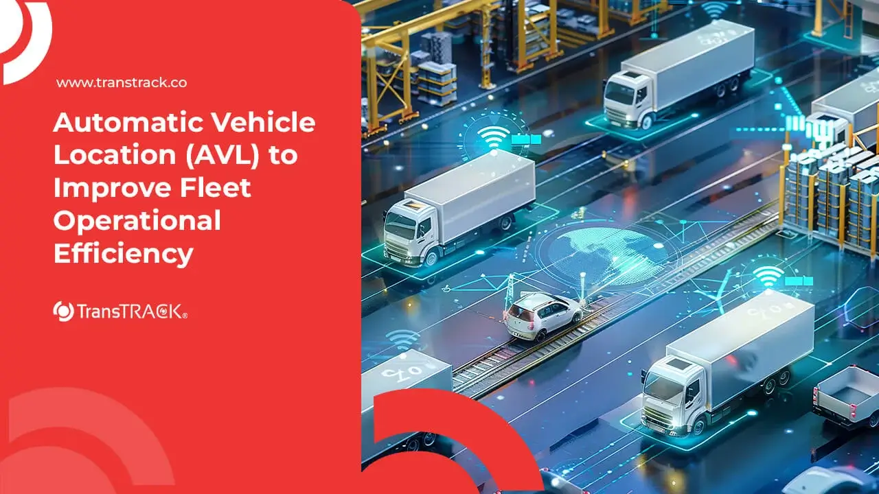
Automatic Vehicle Location (AVL) is a technology that enables companies to automatically monitor the location and movement of vehicles in real time using GPS, communication networks, and monitoring platforms. This system helps companies improve fleet visibility, asset security, fuel efficiency, and operational accuracy. Read more about it in the following article TransTRACK!
Apa Itu Automatic Vehicle Location (AVL)?
Automatic Vehicle Location (AVL) is a technology used to automatically track and determine a vehicle’s location in real time using a combination of GPS, communication networks, and software-based monitoring systems.
AVL enables companies to track the location, direction, speed, and movement of vehicles without the need for manual checks. Vehicle data is typically transmitted from GPS/telematics devices to a monitoring platform, where it can be viewed by fleet managers via a dashboard.
Key Components of Automatic Vehicle Location Technology
Automatic Vehicle Location (AVL) consists of several integrated components that capture, transmit, process, and display vehicle location data in real time.
1. Hardware
The hardware is used to collect data from vehicles and determine the fleet’s location. Some commonly used devices include:
- GPS Receiver – receives signals from GPS satellites to determine the vehicle’s coordinates, speed, direction, and position.
- Telematics Sensors – collect various types of vehicle data, such as speed, engine condition, fuel consumption, and even driver behavior, depending on the type of sensor used.
- Onboard Transponder – a device installed in a vehicle to identify the vehicle and help transmit operational data to the AVL system.
2. Communication Network (Transmission Network)
The communication network serves as a medium for transmitting data from vehicles to a server or monitoring platform. The technology used may vary depending on operational conditions and company needs, including:
- 4G/5G Cellular Networks – commonly used to transmit vehicle data quickly and in real time in areas with cellular network coverage.
- Satellite – used for vehicles or fleets operating in remote areas with limited cellular coverage.
- LoRaWAN – can be used for low-power, long-range communication, particularly for specific monitoring needs in areas that already have LoRaWAN infrastructure.
3. Software & Servers (Software)
The software and server are designed to receive, store, process, and visualize vehicle data. Its main components include:
- GIS (Geographic Information System) – displays the location and movement of vehicles on a digital map and supports location-based analysis.
- Cloud Storage & Server – stores vehicle data and provides the infrastructure for centralized data processing.
- Monitoring Dashboard – provides fleet managers with a real-time view to monitor vehicle locations, statuses, trips, and operational information.
These three components work together as a single unit: the hardware collects data → the communication network transmits the data → the software and server process the information and display it to the fleet manager.
How Does an Automatic Vehicle Location System Work?
Automatic Vehicle Location (AVL) operates through a series of processes that enable vehicle location data to be collected, transmitted, processed, and displayed in real time. In general, the process consists of three main stages:
1. Location Data Collection (Data Acquisition)
The first stage begins when the GPS receiver or telematics device installed in the vehicle picks up a signal from a satellite to determine the vehicle’s position. The device then collects various supporting data, such as:
- Vehicle location coordinates
- Speed and direction of travel
- Travel time
- Vehicle Status
- Vehicle sensor data, if available
The data is collected periodically according to the AVL system configuration.
2. Transmisi Data Real-Time (Data Transmission)
Once the data has been collected, the telematics device sends it to a server or cloud platform via the available communication network.
The network used can be 4G/5G, a satellite network, or LoRaWAN, depending on the needs and conditions of the operational area. The data is then transmitted to the central system so that vehicle information can be updated in real time.
3. Data Processing and Visualization (Data Processing & Display)
The server receives and processes data sent from the vehicles. The AVL system then converts that data into easy-to-understand information via a monitoring dashboard and GIS-based digital maps.
Fleet managers can view:
- Real-time vehicle location
- Vehicle Movement and Routes
- Vehicle speed
- Travel History
- Vehicle Status
- Geofences and specific notifications
- Estimated Time of Arrival (ETA)
Thus, the AVL workflow can be simplified as follows:
GPS/Telematics → Data Collection → Transmission → Server/Cloud → Processing → Monitoring Dashboard → Fleet Manager
This system enables companies to have real-time fleet visibility and use location data as a basis for improving operational control and efficiency.
Key Features & Strategic Benefits of AVL for Fleet Management
AVL offers a variety of features that help companies improve fleet control and operational efficiency, including:
- Real-Time Live Tracking & Geofencing: Monitor vehicle locations in real time and set operational boundaries. The system can send notifications when a vehicle leaves a designated area or route.
- Driver Behavior Monitoring: Monitors driver behavior during trips, such as sudden braking, harsh acceleration, speeding, and idling. This data helps improve safety while reducing unnecessary fuel consumption.
- Route Optimization & Maintenance Alerts: Helps determine more efficient travel routes and provides vehicle maintenance reminders based on mileage, time, or vehicle usage.
Key Benefits of AVL Systems for Business Operations
The implementation of the Automatic Vehicle Location (AVL) system helps companies improve efficiency, safety, and service quality through real-time fleet visibility.
- Fuel Efficiency: Monitoring vehicle trips, speed, and idling so that companies can reduce inefficient fuel consumption.
- Enhanced Asset Security: The vehicle tracking feature helps detect potential theft, while the remote engine cut-off can be used to shut off the engine remotely under certain conditions.
- Improved Accuracy of Estimated Time of Arrival (ETA): Real-time location and trip data help generate more accurate estimated times of arrival, enabling companies to improve service reliability and customer satisfaction.
Challenges in Implementing the AVL System and How to Overcome Them
Although AVL can improve fleet visibility and efficiency, its implementation still presents several challenges that need to be addressed:
- Communication network limitations: Certain operational areas may have weak cellular signals. Solution: Use devices with multi-network support or satellite connectivity for remote areas.
- Implementation and integration costs: Procuring hardware, software, and integrating with existing systems may require an initial investment. Solution: Implement the solution in phases and choose a system that supports integration via APIs.
- User and driver adaptation: The adoption of new technology may face resistance from operational teams. Solution: Provide training and awareness sessions on the benefits of AVL for safety and work efficiency.
- Data accuracy and quality: Location data may be affected by network, environmental, or device conditions. Solution: Use reliable telematics devices and perform regular system monitoring and maintenance.
Conclusion
Automatic Vehicle Location (AVL) is a key technology for improving fleet visibility and control through real-time vehicle monitoring. With features such as live tracking, geofencing, driver behavior monitoring, route optimization, and maintenance alerts, AVL helps companies improve fuel efficiency, asset security, and delivery timeliness.
To get the most out of AVL, companies can integrate it with Fleet Management System (FMS). Through the TransTRACK FMS, vehicle data can be monitored and managed on a single platform to help companies optimize productivity, safety, and fleet operational efficiency.
Optimize your fleet management with the Fleet Management System from TransTRACK. Find a solution that fits your business’s operational needs and improve fleet performance with more integrated data.
FAQ
What is the main difference between a standard GPS tracker and Automatic Vehicle Location (AVL)?
GPS trackers are generally used to determine and transmit a vehicle’s location. Meanwhile, AVL is a more integrated system for collecting, transmitting, processing, and displaying vehicle location data in real time. AVL can also be connected to features such as geofencing, driver monitoring, and route optimization.
Which industries have the greatest need for an Automatic Vehicle Location System?
AVL is widely used by industries that manage vehicle fleets, such as logistics and transportation, FMCG and retail, mining, plantations, vehicle rentals, public transportation, and ports and marine operations. This technology helps companies improve fleet visibility, security, and operational efficiency.
Can the AVL system function when a vehicle passes through an area with no cell service?
Yes, it depends on the communication technology used. AVL systems that rely solely on cellular networks may face limitations in areas without a signal. However, devices with satellite connectivity or alternative communication technologies can still transmit data from areas with limited cellular coverage.
How does the AVL system help reduce fleet operating costs?
AVL helps reduce costs through fuel consumption monitoring, idling reduction, route optimization, driver behavior monitoring, and more scheduled vehicle maintenance. This operational data helps companies reduce waste and improve fleet utilization.
Recent Post




Topic :